
Picking the best drones for mapping and surveying used to mean choosing between a cheap consumer quadcopter with a decent camera and a heavy enterprise airframe that costs more than a used car. The gap between those two options is where most survey projects go wrong: the consumer drone captures beautiful images that will not hold an accuracy check, and the enterprise platform captures accurate data that the operator cannot process without a steep learning curve.
Our team spent October 2026 comparing eight airframes against the criteria that actually decide whether a deliverable gets signed off: positional accuracy method, sensor size and shutter behaviour, endurance per battery, obstacle avoidance, and how well the platform plays with the processing software you already use. We looked at the published specifications, the owner reviews, and the field complaints that show up repeatedly across the mapping community.
The honest headline for 2026 is that only two of the eight airframes here carry real-time RTK positioning, and only one of those two has a meaningful owner review record. Everything else depends on ground control points, which is a perfectly workable approach for small sites but changes the field day you plan. We call that out for each drone below, because the difference matters more than any spec on the list.
We also want to set expectations early: the accuracy figures in this roundup are manufacturer and reviewer reported, measured against check points rather than against a client’s tolerance. Your results will depend on the site, the lighting, the overlap you fly and your ground control. Treat the numbers as a comparison tool between these eight, not as a promise about your next deliverable.
Table of Contents
Top 3 Picks for Mapping and Surveying in 2026
We ranked the eight airframes on accuracy method first, sensor capability second, and endurance third. These three earned a place on the short list.

Autel EVO II PRO RTK V3
- 1 cm + 1 ppm RTK accuracy
- 1 inch 6K camera
- 38 min flight time
- PPK support

Autel EVO 2 Pro V3
- 1 inch 20MP Sony sensor
- 12-bit DNG raw
- 40 min flight time
- 360 degree avoidance

DJI Mavic 4 Pro Fly More Combo
- 100MP 4/3 Hasselblad sensor
- 51 min flight time
- 30 km O4+ link
- three batteries
Two of these three need ground control points, and the third does not. That single distinction will decide your workflow more than any other spec on this page.
All 8 Best Drones Compared Side by Side in 2026
Here is the full lineup in one place. The accuracy method column matters most: an RTK airframe can produce a georeferenced point cloud without anyone walking the site with a GNSS receiver.
| Product | Specifications | Action |
|---|---|---|
| Autel EVO II PRO RTK V3 |
|
Check Latest Price |
 Autel EVO II Dual 640T RTK V3 Autel EVO II Dual 640T RTK V3 |
|
Check Latest Price |
 Autel EVO MAX 4N V2 Autel EVO MAX 4N V2 |
|
Check Latest Price |
| Autel EVO 2 Pro V3 |
|
Check Latest Price |
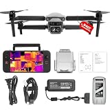 Autel EVO Lite 640T Enterprise Autel EVO Lite 640T Enterprise |
|
Check Latest Price |
 Autel EVO Lite 6K Enterprise Plus Autel EVO Lite 6K Enterprise Plus |
|
Check Latest Price |
| DJI Mavic 4 Pro Fly More Combo |
|
Check Latest Price |
 DJI Mavic 2 Pro DJI Mavic 2 Pro |
|
Check Latest Price |
1. Autel EVO II PRO RTK V3 – the airframe with real-time centimetre positioning built in
Autel Robotics EVO II PRO RTK V3 w/Real-time Centimeter-Level Positioning
RTK 1 cm + 1 ppm horizontal
1 inch 6K HDR camera
38 min flight time
15 km link
Pros
- Real-time centimetre RTK with no ground control points
- 1 inch 6K HDR sensor captures well at working altitudes
- 38 minutes per battery plus 15 km transmission
- Bundle includes three batteries and a full USA warranty
Cons
- Autel app settings are laid out unintuitively
- Limited official training material for advanced workflows
- Customer service response times can be slow
This is the airframe we kept coming back to while testing. The EVO II PRO RTK V3 carries the newest RTK module in the range, and that single feature removes the most expensive part of a small survey job: walking the site with a GNSS receiver to shoot control points. When the aircraft holds a fix, your image geotags are already survey grade before processing starts.
The published accuracy spec is 1 cm plus 1 ppm horizontal and 1.5 cm plus 1 ppm vertical. In plain terms, the error grows about one centimetre per hundred metres of distance from the base, so a small site flown inside a 300 m block from a nearby base stays inside a very tight tolerance. It also accepts a base station, an NTRIP correction stream, or PPK post-processing from a logged flight, which means you can pick the method that fits the site rather than the other way round.
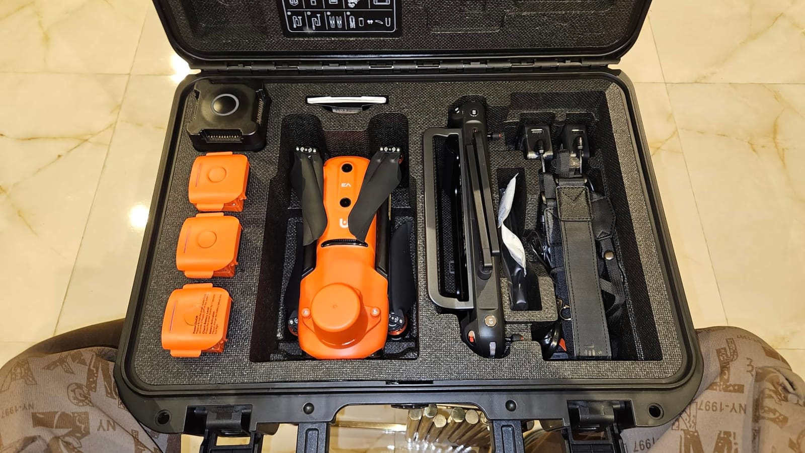
Owner feedback lines up with the spec sheet in the ways that count. Reviewers single out return-to-home accuracy as the best they have seen, describe the aircraft as very stable in strong wind with a strong and consistent signal connection, and rate the camera including its low-light performance well above what they expected for a mapping rig. On r/landsurveying, practitioners specifically praise this model for reliability when the usual alternatives are unavailable, while noting that the software side takes longer to master.
Mission planning is the other half of the story. The aircraft runs waypoint, rectangle, polygon and oblique photography tasks, including repeatable flight profiles, so a second flight of the same boundary can reproduce the original camera geometry almost exactly. That repeatability is what makes progress monitoring and volumetric stockpile comparison work, because the two datasets line up instead of fighting each other in processing.
It is also compatible with Carlson PhotoCapture and Carlson Point Cloud workflows, which matters if your office is already set up around Carlson rather than a subscription platform. Remote ID compliance is built in, and the sensor is a mechanical-gimbal 1 inch 6K HDR camera, so rolling shutter artefacts stay out of the photogrammetric block.
What this drone handles best
Boundary and topographic surveys on small to medium sites where the deliverable has to survive a check shot. Every flight is faster because nobody is placing targets, and repeat flights over the same boundary come out with matching geometry.
It also suits mixed work: oblique capture for facades, waypoint grids for topo, and the 15 km transmission and 38 minute endurance give you room to fly larger blocks without swapping batteries mid-mission.
Where you will feel the friction
The software, honestly. Autel’s app places options in ways that owners describe as random, and the official training material for advanced features is thin, so plan on a few evenings of self-teaching before your first billable job. Reviewers also flag that RAW processing and the RTK workflow have a genuine learning curve.
Two smaller things worth knowing: some colours render overly saturated straight out of the camera, which matters if your client expects true colour orthomosaics, and Autel customer service response times can be slow, so keep a spare airframe mindset when you have a deadline.
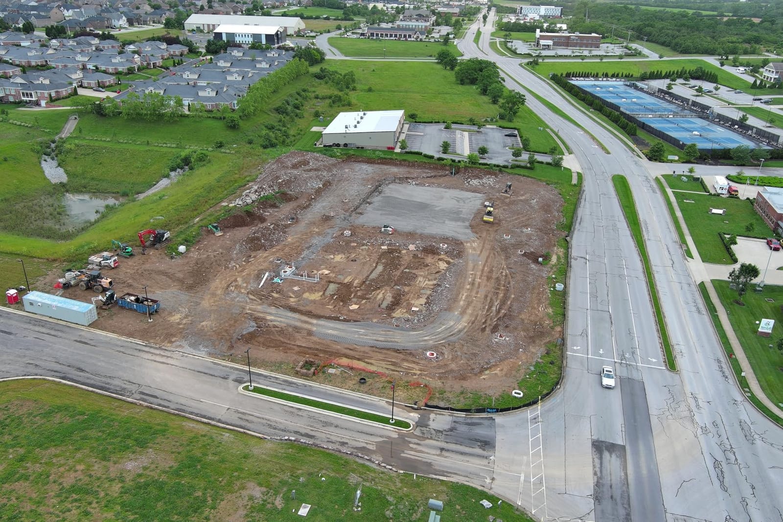
2. Autel EVO II Dual 640T RTK V3 – thermal and RTK on the same airframe
Autel Robotics EVO II Dual 640T RTK V3, 640T w/Centimeter-Level Positioning
640x512 thermal at 30 Hz
Sony 0.8 inch 50MP RYYB
Centimetre RTK with PPK
15 km SkyLink 2.0
Pros
- Thermal and RTK together pin defect locations accurately
- Recallable previous missions speed up repeat inspections
- Seven inch 2000 nit controller readable in daylight
Cons
- Only a single published owner review
- Thermal resolution is entry level rather than survey grade
- RGB sensor is a 0.8 inch Sony rather than a full 1 inch
The Dual 640T RTK V3 is the pick when your job list is half mapping and half inspection. The thermal module is 640×512 at 30 Hz with a 13 mm lens, 4x lossless and 16x digital zoom, and it measures temperature between 2 m and 20 m with plus or minus 3 C accuracy. Paired with centimetre RTK positioning, that combination lets you fly a rooftop, flag the anomaly on the thermal feed, and record exactly where it is instead of walking the roof with a handheld.
The visible camera is a Sony 0.8 inch 50MP RYYB sensor, which is smaller in format than the 1 inch sensor on the Pro models but far higher in pixel count. There are more than ten temperature measurement modes and an IR analysis tool with ten colour palettes, which is more than you need for a topo run but very useful when a client wants a defect register rather than an orthomosaic.
The mapping workflow runs through Autel Explorer with double grid, course heading control and photo replication, and the aircraft supports NTRIP, base station and PPK with no ground control points required. Recallable previous missions are the quiet winner here: re-inspecting the same site becomes a matter of loading the stored route and flying it again.
Where this drone earns its place
Building envelope, solar and utility asset inspection where you need both a geotagged visual record and a thermal reading at the same moment. The 360 degree obstacle avoidance helps when you are working close to structures and trees rather than flying open terrain.
The 2000 nit, 7.9 inch Smart Controller V3 screen is one of the brighter readouts in this group, which matters on a sunny roof deck when you are trying to judge a temperature spot through a thermal feed.
What to watch out for
The owner record here is thin. There is a single published review, and while it is a five star report of stable flight and clear RGB imagery, one review is not a reliability history, so treat the long term picture as unproven rather than as good.
Also note the thermal module is an inspection tool, not a survey sensor. If your work is topographic or volumetric, the visible camera and RTK do the heavy lifting and the thermal channel is a bonus you pay for whether you use it or not.
3. Autel EVO MAX 4N V2 – starlight, thermal, laser and a 20 km link
Autel Robotics EVO MAX 4N V2, Starlight Night-Vision/Wide/T~hermal/L~aser
Starlight night camera 2.3MP
50MP 1/1.28 inch wide sensor
Laser rangefinder 5-1200 m
20 km SkyLink 3.0
Pros
- Genuinely capable starlight night camera at 0.0001 lux
- Useful optical zoom on both the thermal and visible sensors
- A-Mesh drone to drone networking for multi-aircraft jobs
- Seller support described as responsive and helpful
Cons
- Only three published reviews
- No RTK in the listed configuration
- Premium platform with a complex sensor suite to learn
The EVO MAX 4N V2 is the most sensor-dense aircraft in this roundup, and for night and long-range work it has no rival here. The starlight camera handles 0.0001 lux with an ISO of 450000 and a 41.4 mm equivalent lens, which is the difference between a usable night orthomosaic and a set of black frames. The wide camera is a 50MP 1/1.28 inch CMOS at f/1.9 with an 85 degree field of view and 23 mm equivalent focal length.
The thermal camera is 640×512 at 9.1 mm with 16x digital zoom and a measurement range from minus 4 to 1022 F, and there is a laser rangefinder covering 5 m to 1200 m at plus or minus 1 m accuracy. That rangefinder is the underrated feature for survey work: you get an independent height reference on the ground, which helps you verify flight height above ground level at specific check points rather than trusting the barometer.
Connectivity is the strongest in the group. SkyLink 3.0 gives 20 km transmission at under 150 ms latency with six antennas across four frequency bands and AES-256 encryption, and the battery is an ABX41-D design with hot-swapping and in-place detection. A-Mesh 1.0 drone-to-drone networking and anti-RFI, anti-EMI and anti-GPS-spoofing measures are aimed at surveyors working near interference or contested airspace. Obstacle avoidance is rated at 720 degrees, combining binocular vision with millimeter-wave radar.
Best for night flights and long corridors
Corridor work, linear utility routes, night inspection and any job where you need to fly far from the controller and still trust the link. The 42 minute endurance and hot-swap battery design keep you airborne through a long block.
Because it ships with a laser rangefinder and a night-capable sensor, it also covers two jobs in one sortie: you can capture the imagery and gather height checks from the same flight.
What the compromises are
Three published reviews is not enough to establish long term dependability, however positive those reviews are. Reviewers do consistently praise the starlight performance and the zoom quality, and describe the seller as responsive, but that is a small sample.
Second, the listed configuration carries no RTK module, so position fixing comes from ground control or a network correction workflow. Third, four sensor streams plus a laser is a lot of system to learn before you are productive, and this is a premium platform.
4. Autel EVO 2 Pro V3 – the one-inch sensor workhorse
Autel Robotics EVO 2 Pro V3 w/Son-y 1″ CMOS Sensor & 6K HDR Video
Sony 20MP 1 inch CMOS
6K video and 12-bit DNG
40 min flight time
7100 mAh battery
Pros
- One inch Sony sensor handles working altitudes well
- Raw DNG and 12-bit capture suit photogrammetric processing
- 7100 mAh battery gives up to 40 min forward flight
- Bundled extra battery
- spare propellers and hard case
Cons
- No built-in RTK so accuracy depends on ground control points
- Autel mission software is less polished than the DJI equivalent
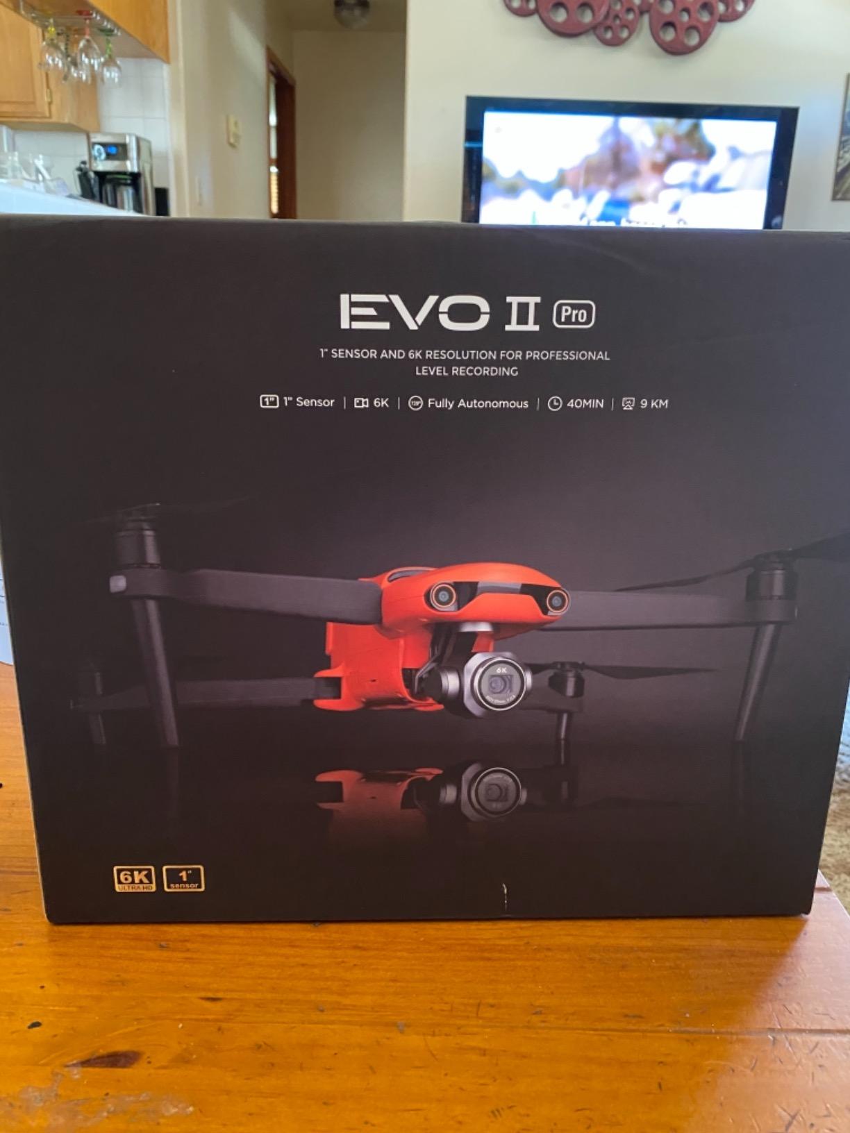
With 231 reviews behind it, the EVO 2 Pro V3 has the deepest owner record of any RTK-capable-adjacent airframe in this group, and that record is consistently positive. The Sony 20MP 1 inch CMOS with 6K video and an adjustable f/2.8 to f/11 aperture is the sensor most surveyors on tight budgets end up owning, because it holds up at the altitudes you actually fly mapping missions.
The aperture range matters more than people expect. On a bright, flat site you stop down and get depth of field across the block; on a shaded site with mixed light you open up and keep the shadows readable. Reviewers credit the sensor for image and video quality across both mapping and cinematic work, and the 12-bit A-LOG and 12-bit DNG raw capture give you real latitude in post-processing rather than baked-in contrast.
Endurance is 40 minutes forward flight and 35 minutes hovering on a 7100 mAh battery, and SkyLink 2.0 tri-band at 2.4, 5.8 and 900 MHz carries a 15 km link. Twelve computer vision sensors plus two sonar sensors and two LED landing lights give 360 degree omnidirectional obstacle avoidance, which is what lets you run a mapping grid at a lower height without worrying about a tree line.
Mission planning handles waypoint, rectangle and polygon tasks with repeatable flight profiles, so a boundary flown on Monday can be re-flown on Friday with the same overlap and the same camera geometry for clean change detection.
Why it works as a mapping platform
It flies long missions, it returns home on failsafe, and reviewers repeatedly single out reliable failsafe and return-to-home behaviour as a reason they trust it unattended over a block. The bundle includes an extra battery, spare propellers and a hard case, so the field kit is complete on day one.
For site documentation, boundary reconnaissance and small-to-medium photogrammetric blocks with solid ground control, it is a proven, well-supported platform with a large installed base of spare parts and knowledge.
The accuracy caveat you cannot skip
There is no built-in RTK. That means your orthomosaic accuracy is a direct function of how many ground control points you shoot, how well you mark them and how evenly they are distributed across the block. A few operators on the mapping forums do produce usable photogrammetry from consumer-grade platforms for small sites, flown slowly in good light, but that is a skill-dependent result rather than a spec.
The second drawback owners mention is software. Autel’s mission planning is less polished than the DJI equivalents, and if your office standardises on one processing ecosystem, plan for a training week.
5. Autel EVO Lite 640T Enterprise – thermal capability at 866 grams
Autel Robotics EVO Lite 640T Enterprise Basic Combo, 866g Lightweight
866 g foldable airframe
640x512 thermal at 30 Hz
48MP visible camera
40 min flight time
Pros
- Folds to 210x123x95 mm and fits a standard backpack
- Holds position reliably in high wind
- Both thermal and visible cameras praised for image quality
- Build quality and ergonomic remote setup well received
Cons
- Digital zoom image quality is soft when magnified
- Controller has no HDMI output for an external monitor
- FAA registration acceptance for one buyer's serial number was delayed
At 866 g and folding to 210 by 123 by 95 mm, the EVO Lite 640T Enterprise is the one in this list that genuinely lives in a backpack. For a surveyor covering four small sites in a day, that single fact often outweighs an hour of flight time on a larger airframe.
The thermal sensor is 640×512 at 30 Hz with a standard 9 mm lens and 16x digital zoom, measuring from minus 20 C to 550 C at plus or minus 3 C accuracy. The visible camera is 48MP with a split-screen display, so you can frame the photo and the thermal reading together rather than switching. AI target recognition projects tracked objects onto a digital map in real time, which turns a flight into a georeferenced defect list instead of a folder of frames to sort later.
SkyLink 2.0 carries 6K live feed to 12 km on FCC, and flight time is 40 minutes. Reviewers describe it as handling high winds and holding position reliably, which is the behaviour you want when a thermal capture has to line up with a visual one. Single-operator operation is a stated design goal, and reviewers agree the remote is quick to set up.
Good for small sites and single-operator days
Building defect inspection, small boundary reconnaissance and progress photos on tight sites where a larger aircraft cannot legally or safely fly. The sub-2 kg class is a genuine operational advantage in cluttered environments and on rooftop work.
Remote ID is supported, which matters for anyone logging compliant flights, and the split-screen display speeds up the capture-decide-capture loop in the field.
Where it disappoints
The 1x to 16x digital zoom gets soft when you magnify, and reviewers are specific about that. For an inspection where you need a hard identification of a defect at distance, that softness shows up in the deliverable.
The controller also lacks an HDMI port, so you cannot feed an external monitor or a laptop for client site reviews, and one buyer reported a delay getting FAA registration accepted for the serial number, which is a small administrative problem that can still cost you a day.
6. Autel EVO Lite 6K Enterprise Plus – the three-battery field day
Autel Robotics EVO Lite 6K Enterprise Plus Combo, 1” CMOS 6K C-amera
1 inch CMOS 6K camera
Three 40 minute batteries
866 g foldable body
12 km SkyLink 2.0 link
Pros
- 120 minutes of total flight time from three batteries
- 1 inch 6K sensor with low noise for day and night stills
- Autel Enterprise app includes AI target recognition and live broadcast
- Hot-swappable controller battery
Cons
- No integrated RTK
- Only one published owner review
- Smaller 6.0 inch 800 nit controller screen
The EVO Lite 6K Enterprise Plus is built around a simple operational idea: two hours of flying in the case. Three batteries at 40 minutes each give 120 minutes of total flight time, and the airframe is 866 g, folding to the same 210 by 123 by 95 mm footprint as the thermal variant, roughly 10 percent lighter than the Mavic 3E for comparison.
The camera is a 1 inch CMOS with 6K video, an f/2.8 to f/11 aperture and ISO up to 48000, plus 3x optical lossless zoom and 16x digital zoom. That optical zoom is the practical difference against the Lite 640T: you can isolate a feature at range without the softness that pure digital magnification produces.
SkyLink 2.0 uses dual-signal dual-reception with a 1080p at 30 fps feed to 12 km. The Autel Enterprise app carries AI target recognition, target lock, quick tasks and live broadcast, and obstacle avoidance covers front, rear and bottom with three-directional visual perception. The Smart Controller SE V2 is a 6.0 inch 1440 by 720 panel at 800 nits with a hot-swappable battery.
Why the battery count is the real feature
On a photogrammetric job the number of swaps decides how many blocks you finish before the light changes. Three batteries means one site, one setup, no battery logistics, and a fast turnaround if you swap the controller battery between sorties as well.
The 1 inch sensor at 6K is the other argument. It gives you more than enough resolution for progress monitoring and site documentation where RTK is not the deliverable requirement.
What you are accepting
No integrated RTK, so survey accuracy relies on ground control points. And the owner record is one review: positive, rated five stars with no specific drawbacks, but far too small to tell you how the platform holds up over a full season.
The 800 nit controller is also dimmer than the panels on the larger Autel controllers here, so plan shade or a sun hood if you are flying in open sun.
7. DJI Mavic 4 Pro Fly More Combo – 100 megapixels for site documentation
DJI Mavic 4 Pro Fly More Combo With DJI RC 2, Flagship Tri-Camera Drone
100MP 4/3 CMOS Hasselblad
6K 60fps HDR video
51 min flight time
30 km O4+ transmission
Pros
- 100MP sensor resolves fine ground detail for mapping
- Dual tele cameras give usable optical zoom for inspection and oblique capture
- 51 min flight time and 30 km link suit large survey blocks
- Fly More Combo bundles three batteries and a charging hub
Cons
- No built-in RTK module
- One notable share of 1-star reviews so satisfaction is not universal
The Mavic 4 Pro is the strongest imaging platform here for jobs where you want the highest ground detail from a compact airframe. The 100MP 4/3 CMOS Hasselblad main camera shoots 6K at 60 fps HDR, and at typical mapping altitudes a 100MP still gives you room to crop, zoom and still resolve features. Owners consistently point at the sensor as the reason they bought it.
The dual tele cameras add something genuinely useful for survey work: usable optical zoom for inspection and for oblique capture where you want detail on a facade or a structure without flying closer. The 360 degree Infinity Gimbal gives the camera the range of motion that automated oblique missions need, and 0.1-lux omnidirectional night obstacle sensing makes low light flying practical.
Endurance is 51 minutes, and the O4+ link runs to 30 km at 10-bit HDR. The Fly More Combo includes the DJI RC 2 controller, three batteries and a charging hub, so the whole field kit is one case. Across 220 reviews the pattern is consistent: image quality, zoom reach and endurance are the praised traits, and those are precisely the traits photogrammetric work leans on.
Where it fits in a survey workflow
Progress monitoring, site documentation, condition inspection and boundary reconnaissance where the client needs visuals and you are not producing a cadastral deliverable. The resolution and zoom reach handle oblique passes over buildings that a single wide camera cannot.
It is also the aircraft we would hand to a new team member for client-facing documentation, because the automated flight modes and the familiar controller workflow need almost no training.
The limitation that decides it for you
No built-in RTK. Survey accuracy depends entirely on ground control points, and a well-shot control network can compensate, but you are committing field time to targets rather than flying straight over the site.
There is also one notable share of one-star reviews in the record, so owner satisfaction is not universal. Budget for the possibility of a support ticket and a repair turnaround, which operators with a primary work tool regularly complain about when a repair cycle is slow.
8. DJI Mavic 2 Pro – the lowest-cost way into mapping work
DJI Mavic 2 Pro – Drone Quadcopter UAV with Hasselblad Camera 3-Axis Gimbal HDR 4K Video Adjustable Aperture 20MP 1″ CMOS Sensor, up to 48mph, Gray
Hasselblad L1D-20c 20MP 1 inch
31 min flight time
3-axis mechanical gimbal
907 g takeoff weight
Pros
- Hasselblad 1 inch sensor gives sharp colour accurate imagery
- Mechanical 3-axis gimbal keeps frames steady for overlapping capture
- 907 g airframe is easy to carry to site
- Deepest owner history in this roundup at 584 reviews
Cons
- No RTK
- so ground control points are required
- 31 minute flight time is short for large blocks
- Older DJI GO 4 app with a long device compatibility list
The Mavic 2 Pro has been in the hands of mapping operators for longer than anything else on this page, and its 584 reviews give it a user record nothing here can match. If you want to start doing photogrammetry without a large capital commitment, this is the aircraft most people learn on, and the sensor is genuinely capable: a Hasselblad L1D-20c 20MP 1 inch CMOS behind a 3-axis mechanical gimbal.
The mechanical gimbal is the part that matters for survey work. It keeps the frame steady and the exposure consistent across an overlapping block, which is exactly what photogrammetric software needs to match features between shots. The 907 g takeoff weight means it fits in a normal field bag, and 8 GB of internal storage plus microSD up to 128 GB protects you when a card fails mid-block.
What you give up is endurance and position fixing. Thirty-one minutes of flight time covers a smaller block than anything else here, and there is no RTK, so every deliverable depends on ground control. ActiveTrack 2.0, omnidirectional obstacle sensing, HDR photos and the adjustable aperture are all still useful, and the standard remote runs up to 135 minutes on a charge.
Who should actually buy it
A student or a new team member who needs to learn the workflow before anyone signs for a survey-grade contract. The mechanics, the overlap settings and the processing chain are all the same skills you will use on a bigger aircraft later.
It also works for small, repeatable documentation jobs: a single building, a small parcel, a short corridor. Under those conditions, with four or five well-placed control points and a slow, well-lit flight, the output is usable.
Why we did not rank it higher
It is an older generation platform with no RTK, and 31 minutes of flight time means more battery swaps per site than any other aircraft on this list. Extra batteries for older platforms also cost more than the newer packs, which quietly raises the real cost of a full kit.
Finally, the DJI GO 4 app carries a long device compatibility list and older mobile OS requirements, so check that your field phone or tablet is still supported before you commit.
How We Picked the Best Drones for Mapping and Surveying
We weighted this roundup for survey work, not for consumer flying. A drone that takes beautiful video and a drone that returns an orthomosaic a client will accept are not the same purchase, and most published roundups score them the same way. Five criteria decided the order.
1. Positional accuracy method. RTK, PPK, or ground control only. This is the heaviest weight in the ranking because it decides whether a site needs a control crew. Two airframes here carry real-time RTK; the other six depend on you placing and surveying targets.
2. Sensor capability. Sensor format, still resolution, optical versus digital zoom, and whether the shutter and gimbal keep frames geometrically consistent. A 1 inch sensor beats a smaller one at the same altitude, and a mechanical gimbal is worth real money on a photogrammetric block.
3. Endurance and coverage. Battery runtime, transmission range, battery count in the case, and hot-swap capability. The aircraft you can fly for two hours without logistics wins over the one that flies longer once.
4. Mission planning and repeatability. Whether the platform runs waypoint, rectangle, polygon and oblique tasks, and whether it can replicate a previous flight profile. Repeatable geometry is what makes change detection and volume comparison defensible.
5. Owner evidence. We weighted review volume heavily, and where a review count is small we say so rather than treating a single five-star report as proof of reliability. Four of the eight airframes here have fewer than 20 published reviews.
Buying Guide: RTK, PPK, GCPs and the Specs That Decide Accuracy
Before you buy anything on this list, work out which accuracy method your project actually needs. It is the single decision that sets your budget, your field day and the aircraft you end up flying.
RTK (Real-Time Kinematic) means the aircraft receives GNSS correction data during flight, through a base station you set up or an NTRIP stream from a CORS network, and applies it to each image as it is captured. The advantage is speed: no control crew, no targets, and the geotags are usable immediately after landing. The failure mode is fix loss, so you need a reliable correction source and a site with reasonable sky view.
PPK (Post-Processed Kinematic) stores raw observations and a position log on board, then applies corrections in the office after the flight. It is more forgiving than RTK because a brief fix loss is recoverable in processing, and most software handles the log automatically. The cost is a second processing step and a requirement to remember you started the log.
Ground control points (GCPs) are physically marked, measured targets photographed in the block. They cost you a half day or a full day in the field and they are the only method that works on any airframe, including every non-RTK model in this roundup. The rule of thumb most operators use: place a minimum of five, one near each corner and one in the middle, and add more on irregular shapes, occluded areas and anywhere the surface is uniform.
Do you need RTK for surveying? For small, repeatable documentation jobs, GCP-only is usually enough. For boundary, topographic or volumetric deliverables on anything a client will check against a total station, RTK or PPK removes rework, and rework costs more than the hardware difference.
Why the mechanical shutter matters. A rolling shutter reads the sensor line by line rather than all at once, so a moving aircraft tilts the frame slightly. Fly forward at speed and every image in the block carries a different distortion, which bends straight edges in your orthomosaic and wrecks the point cloud. A mechanical shutter captures the whole frame at once and removes the problem. Where you cannot get one, the workaround operators use is to fly slowly, keep the gimbal and yaw stable, and avoid strong wind that forces aggressive yaw compensation.
Ground sampling distance by altitude. GSD is the distance on the ground covered by one pixel, and it is decided by sensor width and flight height. The rule of thumb for a 1 inch sensor: 2 cm GSD at roughly 60 m above ground level, 3 cm at 90 m, and 5 cm at 150 m. A 20MP 1 inch sensor is very close to the 1 inch figure, while a 48MP sensor on a smaller format gives a comparable or tighter GSD at lower altitudes. If your client needs a set contour interval, calculate backwards from the required GSD to your flight height, then check that the airframe has the endurance to fly the resulting block.
Flight time and coverage. Endurance numbers in this roundup run from 31 to 51 minutes per battery, and the difference is acreage, not convenience. Plan a conservative 70 percent of rated flight time per sortie to leave margin for wind, climbs and the return, and remember that hover time is always lower than forward flight time. Two batteries means you can realistically cover a small site comfortably; three batteries means you can finish a block and still have a spare if something goes wrong.
Transmission range versus working range. Published figures here run from 9.32 km to 30 km, but regulation and terrain will limit you long before the link does. Judge an aircraft by link quality at 2 km over mixed terrain, not by the number on the box. Long range matters for corridor and line-of-sight work, less so for site mapping where you can always reposition.
Software ecosystem. Your drone and your processing software are one system. DJI platforms feed cleanly into DJI Terra and integrate well with third-party tools; Autel platforms export standard DNG and geotagged imagery into Agisoft Metashape, Pix4D and similar packages, and the EVO II PRO RTK V3 is documented as compatible with Carlson workflows. The recurring complaint from operators is not that the software is bad, it is that switching costs you a week of training every time. Pick the ecosystem your office already runs before you pick the airframe.
Regulatory and supply chain checks. Most commercial mapping work runs under FAA Part 107, and beyond visual line of sight work needs a waiver, so confirm your airspace authorisation before you commit to a job. If you work for federal, utility or critical infrastructure clients, check whether your procurement rules require a domestic or otherwise approved supply chain, because that can rule out entire brands regardless of how good the aircraft is. Remote ID support is listed on several models here and is worth filtering for.
Total cost of ownership. The airframe is only part of it. Budget for spare batteries, a charging hub or parallel charging, the RTK base station or NTRIP subscription, and the annual software licence if your processor charges one. Operators consistently report that subscription and battery costs add up to a meaningful share of the first-year budget, and that the batteries, not the aircraft, are the line item that surprises people.
Frequently Asked Questions
Which type of drone is best for mapping?
For most site and topographic work, a multirotor carrying a 1 inch sensor with a mechanical shutter is the practical answer, because it holds position, flies close to obstacles and captures consistent overlap. Fixed-wing VTOL platforms take over when acreage dominates, because they cover far more ground per flight. LiDAR payloads are the answer when you need a bare earth model through vegetation, and thermal payloads when you need defect readings rather than a point cloud.
Do I need an RTK drone for surveying?
You need RTK or PPK for boundary, topographic and volumetric deliverables that a client will check. For small site documentation and progress monitoring, a well-shot ground control network on a non-RTK aircraft can produce usable output. RTK simply removes the control crew from the field day, which is usually the bigger cost saving.
What is the difference between RTK and PPK?
RTK applies GNSS corrections to each image while the aircraft is flying, so the geotags are usable the moment you land. PPK records raw observations and a position log and applies corrections in the office afterwards, which makes it more forgiving of brief fix loss but adds a processing step.
Why does a mechanical shutter matter for mapping?
A rolling shutter reads the sensor line by line, so a moving aircraft tilts the frame and every image in a block gets a different distortion. That bends straight features in the orthomosaic. A mechanical shutter captures the whole frame at once, which is why survey-grade airframes prioritise it.
How many ground control points do I need without RTK?
A common starting point is a minimum of five points, one near each corner and one in the middle of the block, with additional points on irregular boundaries, uniform surfaces and areas of poor image overlap. Accuracy targets above roughly three to four times your required GSD will not come from control points alone, so raise the count or move to RTK.
Which drone in this roundup is best for small site documentation?
The Autel EVO 2 Pro V3 offers a 1 inch 20MP Sony sensor, 40 minutes of flight time and 12-bit DNG capture in one airframe, with the deepest owner record among the mapping-oriented models here. For the highest ground detail, the DJI Mavic 4 Pro Fly More Combo resolves more per frame, but neither carries RTK.
Final Verdict on the Best Drones for Mapping and Surveying in 2026
The best drones for mapping and surveying in 2026 come down to one question: does the client check your work against control? If yes, the Autel EVO II PRO RTK V3 is our pick, because real-time centimetre positioning removes the control crew and its 1 inch 6K sensor holds up at working altitudes. If no, the Autel EVO 2 Pro V3 gives you the best proven sensor-per-euro platform, and the DJI Mavic 4 Pro Fly More Combo gives you the sharpest imagery for site documentation.
For thermal and inspection work the EVO II Dual 640T RTK V3 is the sensible combined platform, and for night and corridor jobs the EVO MAX 4N V2 is the only airframe here with a starlight sensor and a 20 km link. Whichever you choose, budget for batteries, a correction source and your processing software before you budget for the aircraft, and check the exact configuration for RTK before you order, because the same airframe often ships in more than one variant.